
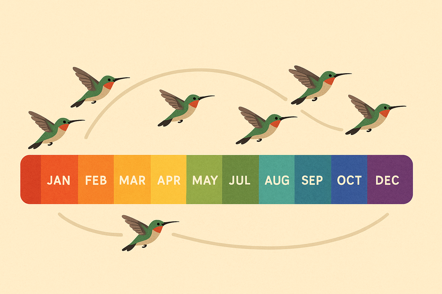
Every year, nature puts on a spectacular show as winged travelers make their way across North America. This guide helps you track their journey with precision.
Our team analyzed a decade of radar data from Cornell Lab’s BirdCast project. The findings reveal exact peak periods for different regions, helping birdwatchers plan their outings.
From the Gulf Coast to the Great Lakes, timing varies significantly. Warmer states see early arrivals, while northern areas welcome species weeks later. Conservation efforts align with these natural rhythms.
Key Takeaways
- Regional timelines differ based on weather and geography
- BirdCast radar data provides accurate movement predictions
- Southern states host early arrivals (February-March)
- Northern regions see peak activity (April-May)
- Conservation strategies match migration waves
Introduction to Spring Bird Migration
Across North America, a natural phenomenon unfolds as countless winged travelers embark on their annual journey. These movements are driven by instinct, survival, and the search for ideal habitats.

Biological triggers like daylight changes and food availability signal when it’s time to move. Over 650 avian species follow these rhythms, each with unique routes and timing. Some fly thousands of miles, while others travel shorter distances.
The U.S. serves as a critical network of pathways connecting nesting and wintering areas. Major corridors like the Mississippi Flyway act as superhighways for these travelers. Celestial cues, Earth’s magnetic field, and even landmarks guide their way.
Climate shifts are altering traditional schedules. Warmer temperatures cause some species to arrive earlier or adjust their routes. Conservationists monitor these changes to protect vulnerable populations.
For those eager to witness this spectacle, our birdwatching guide offers essential tips. Understanding these patterns enhances the experience and supports preservation efforts.
- Instinct & survival drive seasonal movements
- Diverse species use distinct pathways and timing
- Flyways function as vital continental connectors
- Navigation relies on stars, magnetism, and terrain
- Weather changes impact schedules and routes
Understanding the Spring Bird Migration Calendar
Radar technology now reveals the hidden patterns of seasonal avian movements. A decade-long study analyzed 9.4 million scans from 143 weather radar systems nationwide. This data maps the precise ebb and flow of travelers across the continent.
Full Migration Period: March 1–June 15
From March to June, waves of travelers follow nature’s cues. The timeline splits into three distinct phases:
- Early stage (March–April): Waterfowl and early songbirds move north as temperatures rise.
- Peak stage (April 22–May 12): Over 1 billion wings fill the skies nightly, tracked by radar.
- Late stage (May–June): Raptors and stragglers complete the journey.
Peak Migration: April 22–May 12
This 21-day window sees the heaviest traffic. Machine learning analysis shows:
- 90% of movements occur at night, avoiding predators and heat.
- Temperature isotherms (50–60°F) trigger mass departures.
- Songbirds outnumber waterfowl 3:1 during peak nights.
Since 1999, warmer springs have shifted timelines by 1–2 weeks earlier in southern regions. BirdCast’s live maps update nightly, helping enthusiasts track real-time intensity.
Peak Spring Migration Periods Across the U.S.
The United States transforms into a network of avian highways during peak travel seasons. From coastal metros to inland hubs, each state hosts unique waves of travelers. Timing depends on local climates and geographic features.

Western Hotspots
Warmer coastal cities like Los Angeles see activity from April 23 to May 16. Denver’s higher elevation delays arrivals until early May. Golden Gate Park becomes a prime viewing area.
Central Corridors
Chicago’s peak spans April 28 to May 16, aligned with the Great Plains flyway. Houston’s subtropical climate welcomes early travelers by late April. Live radar updates from BirdCast track nightly movements.
Eastern Destinations
New York’s Central Park buzzes from May 1 to 20. Atlantic coast routes differ from western patterns, with cooler temps delaying some species. Urban green spaces offer front-row seats to the action.
- Regional contrasts: Gulf Coast peaks precede Northeastern timelines by 1–2 weeks.
- Urban oases: Parks in major cities provide critical rest stops.
- Microclimates: Coastal fog or mountain winds alter local schedules.
Regional Variations in Migration Timing
The skies tell different stories depending on where you stand in North America. Coastal areas see early movements, while mountain regions experience delayed arrivals. These patterns reflect how geography shapes travel schedules.

Long-Distance vs. Short-Distance Travelers
Nearly 80% of western Gulf travelers journey from the tropics, covering thousands of miles. These neotropical birds contrast with temperate zone species that move shorter distances. Radar shows their routes differ significantly.
California’s Central Valley hosts 5 million overwintering wings before their northbound trek. Stopover sites like this provide critical refueling zones. Weather systems often trigger sudden surges in activity.

Key Travel Corridors in the U.S.
The Mississippi Flyway carries most continental travelers, with radar density maps showing intense activity. Other major routes include:
- Atlantic Flyway: Coastal pathway with urban stopovers
- Central Flyway: Prairie-specialist species highway
- Pacific Flyway: Western mountain-influenced route
Historical data reveals shifting flyway usage, especially during fall returns. Urban light pollution now significantly impacts these natural patterns, prompting conservation measures.
How to Plan Your Birdwatching Activities
Successful sightings depend on strategic planning and understanding avian movements. Whether you’re a beginner or seasoned enthusiast, these tips maximize your chances of witnessing North America’s natural wonders.

Best Times to Observe Migratory Birds
Early mornings offer prime viewing. Radar data shows 83% of travelers pass between 10 PM and 4 AM, but 90 minutes post-sunrise is ideal for spotting active feeders. Overcast days often extend activity windows.
Nocturnal movements peak during warm, calm nights. Tools like BirdCast provide real-time radar updates to plan outings. Weather fronts can trigger sudden surges—check forecasts for low-pressure systems.
Top Locations for Birdwatching
eBird’s 2023 rankings highlight must-visit spots. Coastal areas like High Island, Texas, attract rare species, while Point Pelee, Ontario, offers dense concentrations. Urban parks also serve as critical rest stops.
| Hotspot | Key Species | Peak Dates |
|---|---|---|
| High Island, TX | Warblers, Tanagers | April 10–30 |
| Point Pelee, ON | Thrushes, Orioles | May 1–20 |
| Cape May, NJ | Raptors, Shorebirds | May 5–25 |
Gear and Strategies
- Binoculars: 8×42 magnification balances clarity and portability.
- BirdFlow AI: Predicts rare species arrivals using weather patterns.
- Photography: Use burst mode for flight shots; early light reduces shadows.
- Community Science: Log sightings on eBird to aid research.
Pack layers and rain gear—weather shifts quickly during peak migration. Quiet, earth-toned clothing helps you blend into habitats. Pair tools with patience for the best results.
Protecting Migratory Birds: Conservation Tips
Urban landscapes pose unexpected dangers for traveling species, but simple changes can save lives. Collisions with glass and disorientation from artificial lights claim millions annually. Solutions range from policy shifts to DIY home adjustments.
Lights Out Initiatives
Turning off unnecessary lights during peak travel seasons reduces fatal collisions by 72%. Major cities like Philadelphia saw a 73% drop after implementing ordinances. These programs ask buildings to:
- Extinguish decorative lighting from 11 PM–6 AM
- Close blinds after dark
- Use motion sensors instead of constant illumination
Bird-Friendly Window Treatments
Standard windows become invisible barriers, causing 600,000 annual deaths in Chicago alone. These affordable solutions help:
- ABC-rated films: Apply dotted patterns visible to travelers
- External screens: Install mesh 2–3 inches from glass
- Tempera paint: Create DIY patterns for under $20
| Solution | Effectiveness | Cost |
|---|---|---|
| Window films | Reduces collisions by 90% | $25–$100 |
| FeatherFriendly markers | 83% decrease | $15/roll |
| External netting | 100% prevention | $30–$200 |
Certified bird-safe buildings use frosted or fritted glass. Homeowners can start with small changes—even stickers spaced 4 inches apart make a difference.
Conclusion
Conservation efforts shine when aligned with natural travel patterns. From Gulf Coast early arrivals to northern latecomers, timing varies—but radar tools like BirdCast help predict waves with precision. Upcoming forecast upgrades will refine these insights further.
Prepare for peak activity with essentials: binoculars, weather apps, and eBird alerts. Join Lights Out initiatives to protect nocturnal travelers. Small actions, like window decals or dimmed lights, make a big difference.
Explore FeatherFriendly markers or BirdCast’s live maps to stay engaged. Whether tracking spring movements or fall returns, every observation aids conservation. Nature’s rhythms await—equip yourself to witness and safeguard them.


0 Comments